
Although it’s a bit of a drive, Lost Creek Wilderness in the Tarryall Mountains is a must-see hiking area that features top-notch fall colors and an abundance of unique rock formations. Colors begin to appear in September at higher elevations and descend the slope until mid-October.
At these times, since the elevation on this hike ranges from 8,000 to 10,000 feet, the chances are pretty good that you will see some color somewhere along the way.
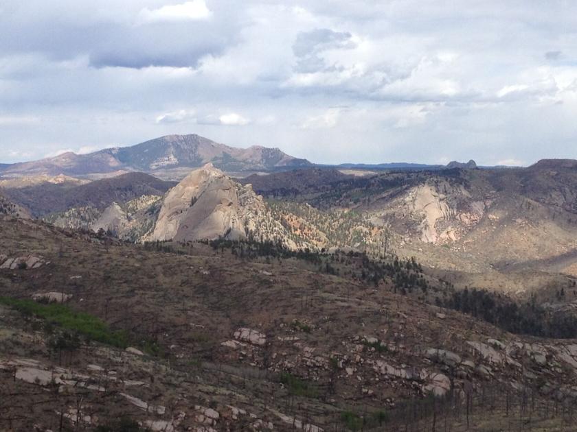
From Colorado Springs head west on US 24 and just past Lake George turn right onto County Road 77 / Tarryall Road. Head north approximately 7 miles and turn right onto dirt road 211. Follow the winding road, where the burn scar from the 2002 Hayman fire created open areas with stunning views to the sky. east of Sheep Rock and Cheesman Mountain. The road passes through many aspen groves offering a colorful tunnel of aspen gold.
After about 17.5 miles turn left onto the dirt road leading to the parking lot at Goose Creek Trailhead about a mile away.
Hike the Goose Creek Trail for about a quarter mile and cross a footbridge. After the bridge, cut left onto Hankins Pass Trail. The trail follows a small cove with about ten crossings. Bridges / logs over the creek can be slippery after rain or snow making this a sure-footed hike. Deciduous shrubs and aspen trees add pops of color to the hike. Hikers may get lucky and spot a common grouse strutting along the trail.
As you climb up to the pass, certain views open up to granite rock formations that inspire the imagination. After approximately 4.5 miles, cross Lake Park Trail and the top of Hankins Pass. The flat terrain of the pass offers an ideal place for a snack break before turning around and retracing the route back to the car park.
Joe LaFleur has lived in Woodland Park since 2016 and is an avid hiker who hikes the trails weekly. Contact Joe with questions or comments at [email protected]. Hiking is great exercise but can be dangerous. Always make sure to plan well, check the weather, bring a printed map and tell someone where, when you are going and contact them when you are safely back.